|
|
| Other Activity |
URBAN LAND MANAGEMENT
• Koraput municipality is radially growing municipality. Jeypore – Vizianagaram Vijayawada- Ranchi corridor are intersected at center of the municipality.
Maximum Growth Rate of town is noticed along the highway
|
Sl.No
|
Land use Category
|
AS per Norms
|
Existing Land use
|
|
Sl.No
|
Land use Category
|
AS per Norms
|
Existing Land use
|
|
1
|
Residential
|
45 - 50
|
56 %
|
|
2
|
Commercial
|
2-3
|
2 %
|
|
4
|
Industrial
|
8-10
|
10%
|
|
5
|
Roads
|
10-12
|
14%
|
|
6
|
Green or Open Space
|
12-14
|
18%
|
Management through regulation in the Land use pattern.
The KORAPUT Regional Improvement Trust (KRIT)) is the agency, which takes care of the land use management and other concerns in the notified urban area. The land use pattern of KORAPUT urban area and all permissions for any type of construction therein is presently guided by
(i) Odisha Development Authority Act,1982/ Rules,1983,
(ii) Interim Development Plan (IDP),
(iii) KORAPUT Regional Improvement Trust (Buildings and Standards) Regulations-2012.
The KORAPUT Regional Improvement Trust (KRIT) was in operation with its jurisdiction over a Master Plan area notified by the Govt. in H&UD Department earlier and the land was regulated as per the then Master Plan (Proposed Land Use). With the institution of KRIT, a new master plan called the Comprehensive Development Plan (CDP) is in the process of development and till the CDP is finalised, the old master plan is being followed as the Interim Development Plan (IDP) as specified in the ODA Act. The Comprehensive Development Plan (CDP) is a much elaborate version of the IDP encompassing a meticulously worked out principle of present day’s urban management studies. The CDP is being developed with the state funds and technical assistance from Town and Country Planning Organization (TCPO) Govt. of India. The CDP is being prepared in a digital base cadastral map, on a GIS platform, for the first time in Odisha.
The Odisha Development Authority Act/ Rules and KORAPUT Reginal Improvement Trust (Buildings and Standards) Regulations governs the land use by permitting and prohibiting different use zones. The use zones are broadly categorized into (i) Uses/Activities Permitted; (ii) Uses/Activities Permitted on special grounds by the Competent Authority and (iii) Uses/Activities Prohibited and the Building Regulations elaborates on the criteria and process of imposing restrictions and penalties.
1.1 Management through regulation in land allotment.
Allotment of government land in the civil township of KORAPUT is governed by a special set of rules under Schedule IV of the Orissa Government Land Settlement Rule (OGLS), 1983. According to this schedule, there shall be a Land Allotment Committee (LAC) to consider and dispose of all applications for allotment of land received from Govt. Departments, private individuals, companies, institutions, societies and local bodies. The Land Allotment Committee shall be chaired by the Revenue Divisional Commissioner (northern div), the Additional District Magistrate shall act as the convener of the Committee and the three other members will be Collector Koraput, Director Town Planning and Director of Industries.
The powers and function of urban land management assigning land planning and use has not been transferred to Municipal Authority till date. The KORAPUT MUNICIPALITY however receives fund for protection of the government land.
1.2 Protection of Govt. Land:-
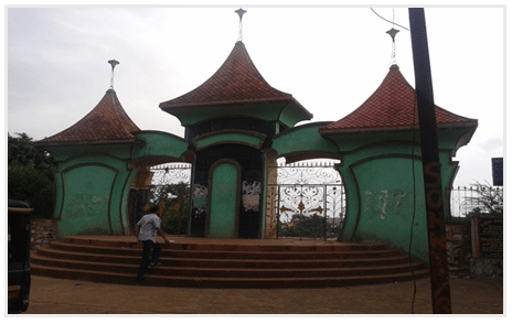
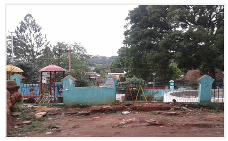
To make KORAPUT free from encroachment KORAPUT Municipal Council has taken a historic decision of making a good number of Parks inside the colonial localities out of BRGF /TFC fund which not only adds to the beauty of the town enhancing aesthetic significance but it also envisages protection of Govt. land. Parks of a uniform design has been selected &. Parks have been made in .
Development of Unused Government Land:
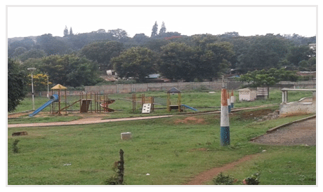
According to Odisha Development Authority Act,1982 10% of the stipulated residential area is to be reserved for “Organized Open Spaces” like gardens, parks and play ground. The KORAPUT Development Authority was handed over 100 Acres of land in the Chend Residential area in KORAPUT municipal area by the revenue department for the development of “Organized Open Space”. The proposed garden is in an area of 9.3 acre.
The garden is rectangular in shape at the convergence point of two 100’0’’road and the third side bounded by a proposed drain of 100’0’’ The layout was planned keeping in view the natural gradation of the land. 20% of the garden area is shallow land and taking into account the natural advantage this part of the garden is proposed to be developed in to a small lake with boating facility. There are three children parks planned inside the garden and trees plantation pattern along with the strolling pathway is also laid out. The entrance and the parking space is also an integral part of the design. The plan is developed with technical assistance from the Planning Member KRIT.
ANALYSIS OF MUNICIPAL FINANACE
Finance is the lifeblood of any administration. For municipal administration, the expenditure side is either oddly or evenly balanced with the revenue generated from the inhabitants by means of taxes auctioning and other sources. Since the amenities like water, sanitation and health are indispensable; the incurred expense of the municipality is big. Since the administration of a municipality involves varieties of tasks and huge amount of resources, planning and budgeting for this is highly important.
LIVELIHOOD ASPECTS
There are varying type livelihood activities both skilled and unskilled is practiced in these slum areas. The majority are however casual laborers. Many livelihood promotion activities are carried out in these slums by the government which is rolled out through the Urban basic Service programme through People Participation.
INTERACTION WITH GOVERNMENT OFFICIALS
The interaction of the people of Koraput Municipality with the government official is mostly through Community Organizers (CO) working under the Project Officer (PO) (KORAPUT MUNICIPALITY) under the broad principals of the “Urban Basic Services Programme.”
The“Urban Basic Services Programme” aims at upgrading the quality of life of the urban poor. It is mainly designed to enhance the survival and development of children and women of the urban low income families in selected, least developed districts of the state. The programme envisages development of urban slums by making provision of basic services such as:
• water supply
• health
• education
• environmental sanitation
• nutrition education
• economic support
• recreation
It involves making efforts to bring awareness and to motivate the community to participate through group action. All the household of the slums are organized in Neighborhood Communities NHC/SHG.
FORMATION OF N.H.C/ SHG
From every 20 households one Voluntary Woman Worker is elected / selected to function as R.C.V. She is responsible for her 20 households/Groups. One neighbourhood committee is constituted for near 100 to 200 households in a basti having only 10 R.C.Vs. The R.C.Vs who formed NHC /select from them one secretary and a President. This NHC draws up its own mini action plan and after getting proper approval from the Project they implement the same. For the implementation NHC work, the members of NHC receive proper support and guidance from the Community Organizers, Who are the employees of concerned Municipality. The Community Organizers are friend, Philosopher and guide to R.C.Vs. Most Important factor is to prepare a slum map indicating target group beneficiaries with list of target beneficiaries, important landmarks in the slum etc. Most of the NHCs are registered under society Registration Act.
All the developmental programmers of the government are implemented through the NHC. There are 3 community centers where there monthly meeting are held. The secretary and a President are nonpolitical positions and are selected by consensus every year. The Public Distribution system of the government has been extended through a number of SHGs working in the slum area. The Pension benefits under various social welfare schemes of the state and the centre are extended through the Executive Officer KORAPUT MUNICIPALITY. For this purpose pension distribution camps are organized in the community centers.
Because of the well-organized structure of the households of the slums into Neighborhood Communities (NHC) there is a streamlined process of dissemination of government information and implementation of basic government services through bottom up planning.
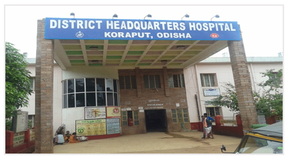
AVALABILITY OF MEDICAL FACILITY .
Health Facilities available in the municipality
|
Sl. No
|
Description
|
Details
|
|
1
|
Government Hospitals
|
1(195beds)
|
|
2
|
Government Dispensary
|
1
|
Distance from Health facility
|
Sl. No
|
Health Facility
|
Distance from nearest facility
|
|
1.
|
Primary Health care/Govt. Hospital
|
Within 2km
|
|
2.
|
Private Clinic
|
Within 1km
|
|
|